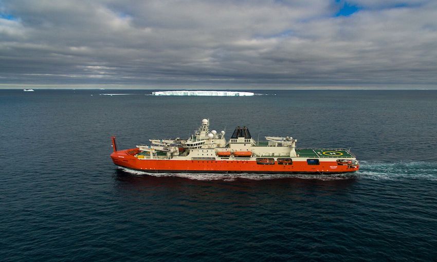
ON its first voyage to Antarctica, Australian icebreaker RSV Nuyina has been collecting environmental data to share with the public.
The research and supply vessel departed Hobart on 23 December to resupply research stations and undertake a marine science commissioning under the Australian Antarctic Program.
Data collected on Nuyina and elsewhere in Antarctica aims to support global efforts to map the world’s oceans by 2030.
The information will also contribute to improved navigation maps; weather, climate and biodiversity models.
Spanning from the atmosphere to the deep ocean, the information is captured through Nuyina’s data collecting sensors.
Australian Antarctic Data Centre manager and big data scientist Dr Johnathan Kool described the ship as a “floating internet of things”.
“Nuyina is a game changer in terms of the breadth of sensors that it has and the amount of information it’s collecting,” he said.
“We have meteorological sensors, seabed mapping and other acoustic sensors, and oceanographic sensors – and they all feed into our data collection system on the ship.”
Wind speed, humidity, vessel speed and orientation, water temperature, salinity, and raw data from the vessel’s acoustic instruments are among the types of information collected.
The kind of research being undertaken and which sensors are turned on determines how much of this data is collected.
“The challenge is to estimate how much storage space we’ll need, and that will depend on whether big data generating systems are turned on, such as high-definition video, radar, or the acoustic instruments,” Dr Kool said.
“Because we’re collecting so much information, we have to think big about how we manage it and distribute it on a much larger scale than anything we’ve done before.”
Once captured, the information is stored in two portable, ruggedised data storage devices that can each store 80 terabytes of data.
The data is then formatted and organised to comply with the Australian Antarctic Division’s onshore data management system.
At the end of each voyage, the data from the hard drives are uploaded to the cloud for anyone to access.
“With the seabed mapping instruments, for example, we amalgamate all sorts of data, including the three-dimensional position and orientation of the ship in space, and waveform information from the acoustic pings bouncing off the seabed,” Dr Kool said.
“Scientists can then download and process it to visualise the structure of the seabed and identify habitat characteristics – such as whether the seabed is rocky or silty.”
Dr Kool said a broad range of people will end up using the data, including atmospheric scientists, meteorologists, biologists, climate experts, and members of the public.
“I’m a firm believer that better information leads to better decisions,” he said.
“In time, my vision is that we can open up our entire Australian Antarctic data collection for big data research.”