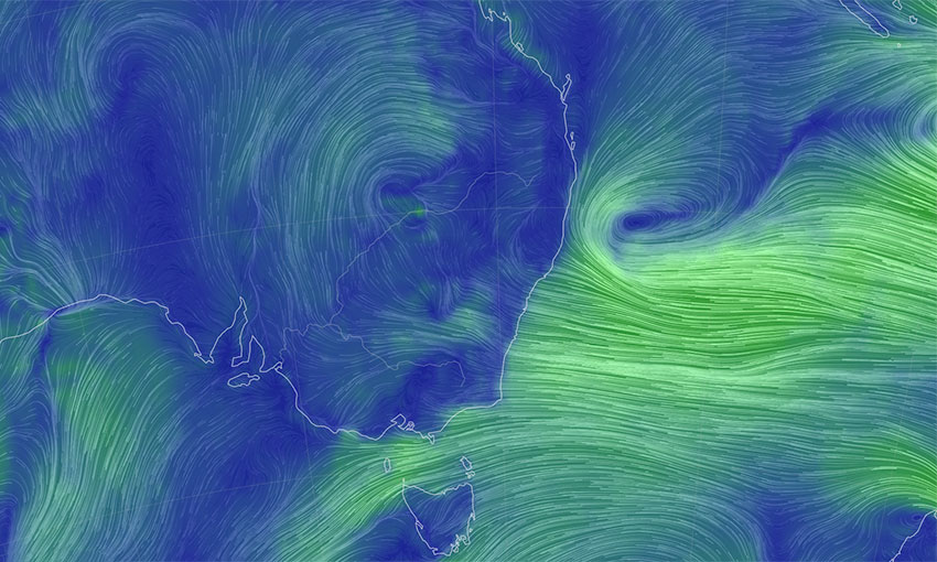
THE Bureau of Meteorology has issued warnings for damaging surf, damaging winds and abnormally high tides for the New South Wales coast – including around the ports of Newcastle, Botany and Port Kembla – as an east coast low approaches the coast on Wednesday.
On Wednesday afternoon, a spokesperson for the Port Authority of New South Wales said shipping movements are being planned to current environmental conditions and there was a “very limited impact so far across most of Port Authority’s ports”.
“Pilotage has been suspended due to heavy seas in Port Kembla and Port Authority is monitoring the situation, with movements allowed on a case-by-case basis,” the spokesperson said.
“Weather conditions are being continuously monitored.”
In a weather warning issued about midday Wednesday, the BOM said a low offshore the mid-North Coast would deepen and move south-westwards towards the central NSW coast and approach the central and south-eastern districts during Wednesday.
The bureau is predicting “intense” and “heavy” rainfall and damaging wind gusts. It said gusts could peak at above 90 kilometres per hour over parts of the coastal fringe. It also said “very heavy surf” was likely to develop along the coast in Newcastle, Sydney and Wollongong, among other areas, from Wednesday afternoon through Thursday afternoon.
According to the BOM, east coast lows are intense low-pressure systems that form off the east coast of Australia. They commonly occur in autumn and winter. These weather systems can intensify over a period of 12 to 24 hours.
The BOM noted that some of Australia’s worst maritime disasters are caused by the destructive winds, torrential rainfall and rough seas that can accompany east coast lows.
The grounding of the Pasha Bulker in Newcastle in June 2007 occurred during a particularly strong east coast low event.


