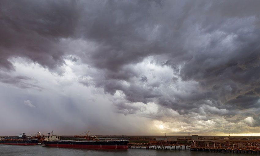
SHIPS have been evacuated from Port Hedland ahead of a tropical low approaching the Pilbara.
According to the Pilbara Ports Authority, the low is forecast to bring gale force winds and significant swell as it approaches the coast.
“Pilbara Ports Authority has cleared the port and anchorages of Port Hedland of large vessels.,” PPA stated.
Port Hedland was experiencing heavy rains and gale force winds on Friday afternoon.
The Bureau of Meteorology issued an update saying the tropical low has crossed the coast between Port Hedland and Whim Creek late morning on Friday local time.
“Winds have now eased in Port Hedland,” the Bureau stated.
A severe weather warning was in place at the time of going publication.
“There is a very slight risk it moves slower than forecast and crosses the coast as late as Saturday morning,” the Bureau said on its website.
“Although the risk of the system being classified as a tropical cyclone is low, there is a moderate to high risk of persistent gale force winds … meaning damaging winds could still be experienced near the low,” the Bureau stated.
“These stronger winds are the result of enhanced monsoonal northwesterly flow and the system’s speed of movement. Heavy rainfall is also expected with the passage of the tropical low.”
The Bureau of Meteorology’s Tropical Cyclone Outlook for the 2020-21 season, released in October, has predicted an average to above average number of cyclones during the wet season, which typically extends from November to April.
Cyclones, which are formed from tropical lows, have had major impacts on iron ore exports in the recent past, with Cyclone Damien flooding mines in the Pilbara.