
-
Posted by Dale Crisp
- |
-
19 March, 2026
THE FIRST tropical cyclone of the season in North Queensland is moving westward from the Coral Sea towards Cape York Peninsula, with the Bureau of Meteorology and the state government warning it could be the most dangerous yet seen.
Tropical Cyclone Narelle is currently rated a Category Five and is expected to bring severe impacts to Far North Queensland during Friday and the eastern Northern Territory on the weekend.
The warning zone encompasses the Cape York Peninsula between Lockhart River and Cape Tribulation, and between Mapoon and Pormpuraaw, including Coen, Cooktown, Weipa, and Aurukun.
In its update at 1300hrs AEST the BoM said Narelle had sustained winds near the centre of 215 kilometres per hour with wind gusts to 295 kilometres per hour.

It was then located within 30 kilometres of 13.7 degrees South 147.0 degrees East, estimated to be 275 kilometres northeast of Cooktown and 410 kilometres east of Coen, and moving west southwest at 28 kph.
Narelle is forecast to cross the Queensland coast between Lockhart River and Cape Melville on Friday morning, with severe impact “very likely”. It is forecast to weaken as it crosses the Peninsula but will then continue to move west across the Gulf of Carpentaria, and to strengthen again to a severe tropical cyclone before impacting the eastern Northern Territory over the weekend.
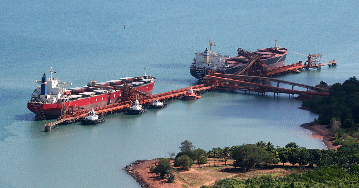
The TC has the potential to affect several mining sites and associated port facilities, including Cape Flattery Silica and Rio Tinto and Metro Mining’s activities in Weipa and Bauxite Hills/Skardon River respectively.
A Rio Tinto spokesperson told DCN: “The safety of our people and the surrounding communities is our top priority and our teams have been monitoring the weather situation and working with the relevant local and state authorities.
“Cyclone response plans have been activated and we are focused on making sure our people are safe and our operations are secure. We will continue to closely monitor the situation and take all necessary precautions."
Comment has been sought from CDS and MM.
In more detail, the BoM advises:
- VERY DESTRUCTIVE WIND GUSTS in excess of 250 km/h are possible near the centre of Severe Tropical Cyclone Narelle as it crosses the Cape York Peninsula coast. VERY DESTRUCTIVE WIND GUSTS will persist about the centre of Narelle for some distance inland.
- DESTRUCTIVE WIND GUSTS to 160 km/h are likely from Lockhart River to Cape Flattery from Thursday night. DESTRUCTIVE WIND GUSTS are likely to persist near the centre of Narelle as it moves across Cape York Peninsula during Friday.
- Gales with DAMAGING WIND GUSTS to 120 km/h are likely between Lockhart River and Cooktown from Thursday evening, and may extend south to Cape Tribulation if Narelle takes a more southerly path. Gales with DAMAGING WIND GUSTS to 120 km/h are also forecast to extent across Cape York Peninsula, including areas between Mapoon and Pormpuraaw during Friday.
- HEAVY RAINFALL which may lead to FLASH FLOODING is possible between Cape Melville and Cape Tribulation from Thursday evening, extending northwards and to inland areas west of Coen during Friday.
- LOCALLY INTENSE RAINFALL is likely in an area of the Peninsula bounded by Lockhart River, Cape Flattery, Pormpuraaw, and Weipa during Friday. Tides will be higher than normal between Coen and Cape Tribulation as Narelle approaches and crosses the coast.
- LARGE WAVES may produce MINOR FLOODING of low-lying coastal areas. There is a small risk that tides may approach the highest tide of the year during Friday. Tides in Princess Charlotte Bay are likely to rise significantly above the normal high tide, with DAMAGING WAVES and DANGEROUS FLOODING. Any coastal residents in this area are specifically warned of a possible DANGEROUS STORM TIDE as the cyclone centre crosses the coast. Once Narelle moves into the Gulf of Carpentaria, tides on the western Peninsula between Weipa and Kowanyama may be higher than normal. LARGE WAVES may produce MINOR FLOODING of low-lying coastal areas.