
-
Posted by David Sexton
- |
-
21 April, 2026
A NEW phase in the digitisation of maritime navigation is underway, as international trials test an advanced data framework aimed at providing mariners a clearer, real-time picture of conditions at sea.
The system, known as S-100 and developed by the International Hydrographic Organization, is said to mark a shift away from static charts toward layered, dynamic data that can improve safety and efficiency.
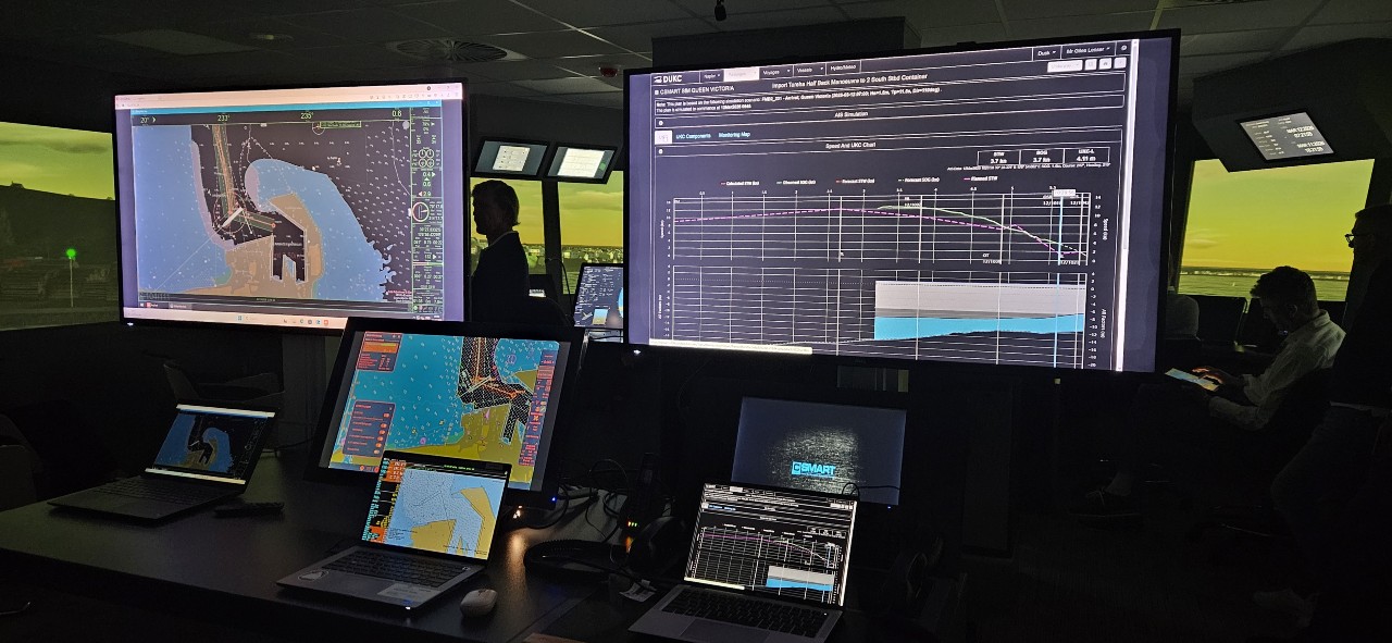
Australian maritime technology firm OMC International is among the companies contributing to the effort, participating in a recent series of bridge simulator trials led by Carnival Corporation via its Center for Simulator Maritime Training (CSMART).
OMC International chief executive Peter O’Brien said the company’s long-standing expertise in under keel clearance management positioned it well to support the transition.
“As the pioneer of dynamic UKC, OMC has deep and extensive expertise in UKC management and is honoured to have Jason Rhee chair the IHO’s S-129 Project Team,” he said.
The trials form part of the IHO’s S-100 Test Bed and Sea Trial in Confined Waters program.
OMC supplied S-129 (under keel clearance management) datasets generated by its Dynamic Under Keel Clearance (DUKC) system—technology that helps determine how much safe water lies beneath a vessel as conditions change.
S-100 represents a significant shift in how navigation data is created and used. Instead of relying solely on fixed chart information, it enables multiple real-time data sources—such as tides, vessel movement and seabed conditions—to be integrated and visualised together, giving mariners a more accurate understanding of operating conditions.
The first phase of the S-100 rollout has now entered into force, allowing IHO member states and industry stakeholders to begin producing and testing selected product specifications, including S-129.
While fully approved S-100-compatible electronic chart display and information systems are not yet widely available, some datasets can already be viewed using pilots’ portable electronic charting software.
“OMC has been providing dynamic chart overlays for integration into electronic charting systems for more than a decade, and the standardisation of this data through S-129 will facilitate industry uptake and enhance user experience," Mr O'Brien said.
The trials brought together a range of international participants, including hydrographic offices, maritime authorities, ports and pilot organisations from Europe, Australia and New Zealand, highlighting efforts to modernise maritime navigation.